Needs and Challenges
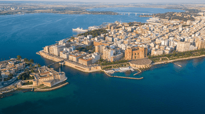
Taranto combines a large industrial area, a commercial and military port, a semi-enclosed coastal ecosystem and mussel farming. Flooding, erosion and pollution compound each other, and water quality is poor due to stagnation. Planners need to know whether removing rigid barriers or using nature-based solutions would improve water quality and reach good environmental status without increasing erosion.
Oceanity Solution and Approach
OCEANITY builds on an existing forecasting system for Taranto Gulf and the SURF relocatable framework in EDITO. It adds wave, circulation, biogeochemistry and flooding components, a coastal-dune module alongside seagrass, and a module to investigate the effect of removing rigid barriers. AI emulators run mixed scenarios, and an agent-based model adds the socio-economic dimension.
Data
Models & digital twin services
Tools for users
Potential Impact
Authorities can compare protection options (seagrass, dunes, barrier removal) before investing.
Better-informed decisions to improve water quality and move towards good environmental status.
Greater urban and coastal resilience to compound hazards: flooding, erosion and pollution.
The relocatable SURF framework lets other coastal areas reuse the approach.